Real context in minutes
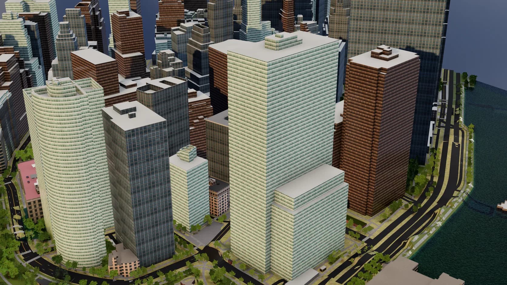
Buildings, roads, water and land use come from OpenStreetMap and sit on real elevation data, in a box up to about 1 km across in city mode.
3D for urban planning
Search an address or draw a box on the map and Studio builds the area: buildings at their mapped heights, streets on the real terrain, water and green space. Then test massing against the neighbours, set the sun and frame the views you want to show.
Buildings, roads, water and land use come from OpenStreetMap and sit on real elevation data, in a box up to about 1 km across in city mode.
Every building and road is an editable object. Hide what is coming down, drop in a proposal, or ask mixos AI to build a massing option from a sketch or a sentence.
Name the date and the time and the sun goes where it really is for those coordinates. It is a visual guide for discussion, not a certified overshadowing analysis.
The import tells you how many building heights were mapped and how many it estimated, so you can see how much of the skyline to trust.
Why Mixos
Early planning conversations go better with a model on the table, and building context by hand can take longer than the meeting it is for. Studio's Real place import does that first step in minutes, so you can spend the time on what could change rather than what is already there.
OpenStreetMap is volunteer-mapped, so quality follows the local mappers. Central districts of large cities are usually complete, often with heights, while suburbs may only have footprints with estimated heights. Check the result against what you know of the place, and use your surveyed and GIS data for anything that has to be right.
It is a design and communication tool. It does not replace GIS, CAD or BIM, does not check zoning or code, and does not produce documents for approval. What it gives you is a scene you can change while people are talking, and images and animated orbits that show the idea.
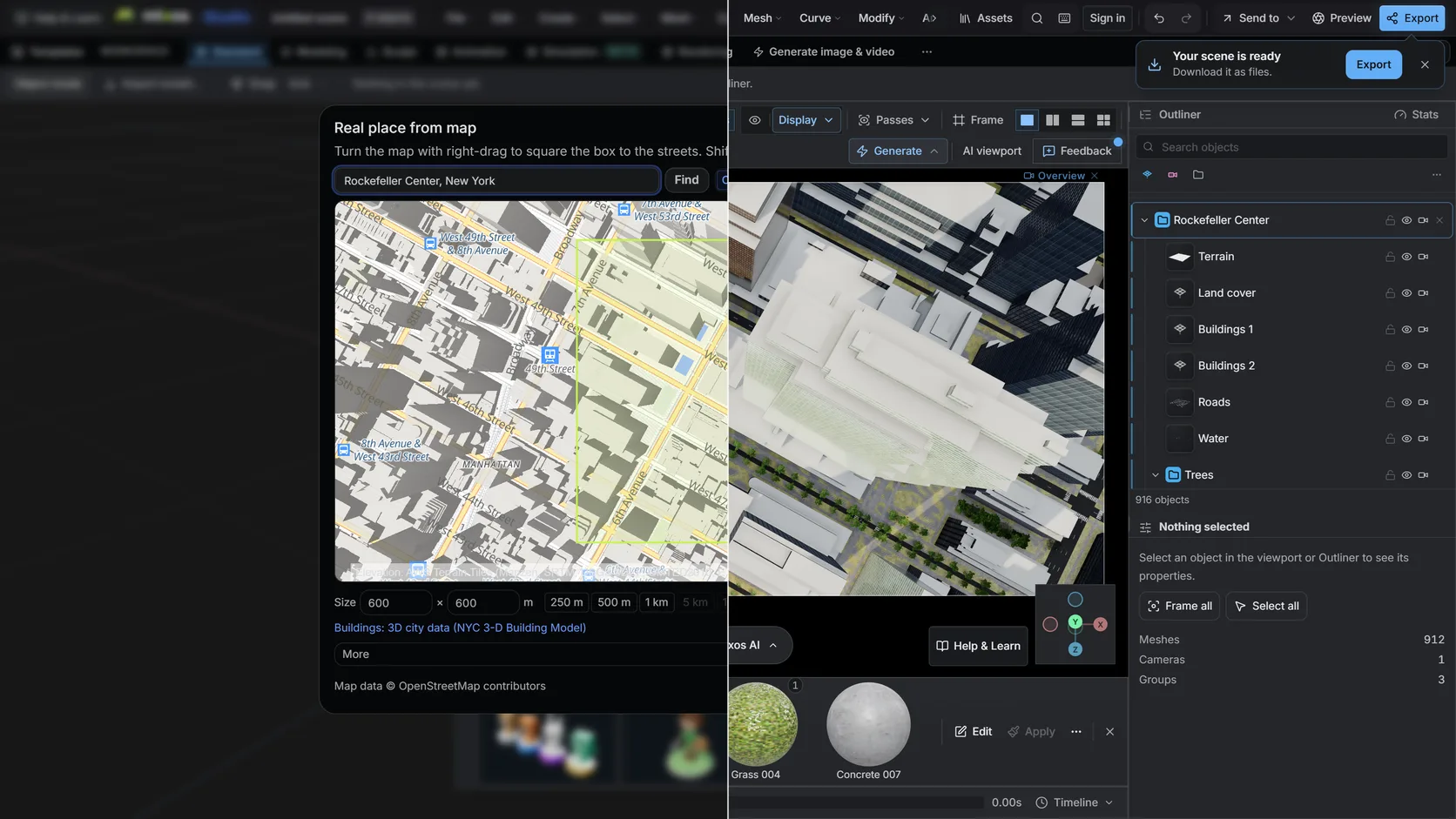
Open Studio's Real place picker, search an address, and draw the box around the site and its neighbours.
Read the report of mapped and estimated heights, then correct or hide the buildings that matter for your question.
Place massing options on the plot, set the sun for the date you care about, and render stills or an orbit for the meeting.
Build the blocks around this address, then add a six-storey mixed-use massing on the empty lot and show it at 5 pm in December.
No. It is a fast 3D design and visualization workspace for early discussion. Use GIS, CAD and BIM tools for analysis, documentation and approvals.
As accurate as OpenStreetMap is for that area. Heights come from tags, then floor counts, then estimates, and the import reports how many were estimated. Facades are styled, not photographed.
Yes. Studio imports glTF, OBJ, FBX, STL and other common 3D formats into the same scene.
Building and rendering in Studio is free. Exporting production files needs a paid plan or a perpetual licence, and mixos AI uses credits.
Read next
Vertices, edges and faces — the box-modelling fundamentals.
Which of the two approaches fits the thing you're making.
Which format keeps materials and which throws them away.
Why the same texture reads bigger on one model than another.
Keep exploring
3D city model generator
OpenStreetMap to 3D
3D terrain generator

Online 3D modeling